
Страна:
Регион:
Другие названия:
Значение:
Время визита:
Цена:
бесплатно
Почему Топ:
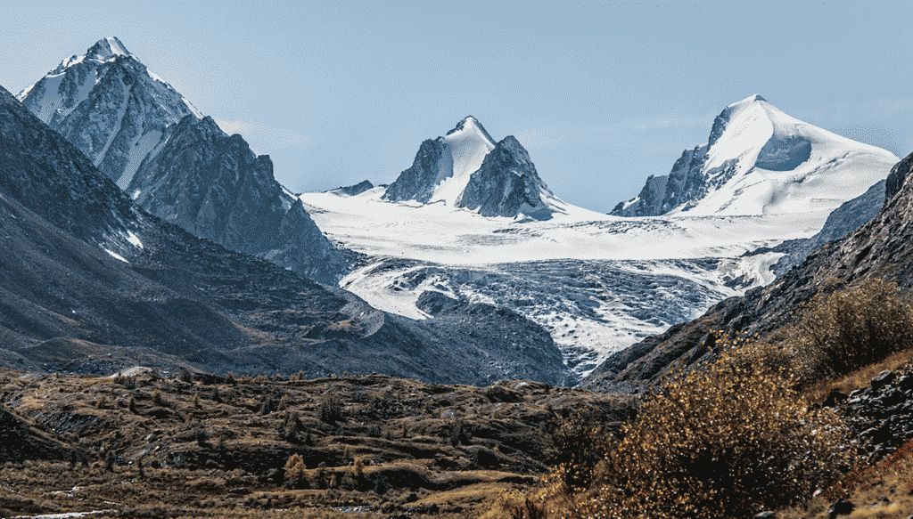
Ледник, спускающийся с горных вершин, образует трещины и морены.
Описание:
One of the largest glaciers in the region. The road to the glacier is as follows: you need to turn off P256 in the village of Ortolyk towards the village of Beltir. You need to drive through the village of Beltir to the end, and immediately after the bridge over the Chagan River turn left. Then the movement continues along the Chagan River, the road often branches and joins, some of the roads go to the camps. This section is quite difficult — there are a lot of large stones, steep climbs and dust, there are a couple of easy fords. Further, the road will pass near lakes Karakol and Akkol and will soon end in marshy areas. There are about 7 kilometers left to the glacier, which can only be covered on foot. The path to the glacier does not require special preparation, but there are difficult sections where you need to walk along a slope made of kurumnik.
Категории:
Темы:
Зачем посещать:
Интерес:
Физподготовка:
Лучшее время:
Доступ:
Roads:
Info:
Clothing:
Seasonal
Connection:
Ok