Home Twitter Telegram
First time here ?     Subscribe
  • Places
    • List
    • List (map left)
    • by Country
    • Table
    • Map
    • Simple view
    • Cameras
  • Services
    • List
    • Map
  • Tours
    • List
    • Map
    • Table
  • Site
    • About
    • Contacts
    • FAQ
    • For Place owners
    • Prices
    • Subscribe
  • Account
    • Login
    • Join (register)
    • Payment
    • Prices
    • Requests
  • Add
    • Add Place
    • Add Tour
    • Add Infrastructure
    • Add Content
    • Add Blog
    • Add Comment
    • Add Event
    • Add Rating
    • Add Request
  • Site Map
  • Partners
  • Support

Places Tours Services News Blogs Articles Events Authors Cameras Add Join

  • PLACES
    • List
    • Map
    • Table
    • List (near me)
    • Map (near me)
  • TOURS
    • List
    • Map
    • Table
  • SERVICES
  • Web Cameras
  • More
    • Blogs
    • News
    • Articles
    • Events
    • Authors
    • Telegram Channel
    • Telegram Chat
  • Site
    • Join compare
    • Plans & Prices
    • Contacts
    • FAQ
  • Add
    • Add Place
    • Add Content
    • Add Event or Date
  • Login
Add Tour
Add Sleep Place
Add Eat Place

Requests are available only for Business users !
Join as Business


Country:

Georgia

Value:

National value

Duration:

1 day

GPS:

41.702278, 41.9512
Go
Map
UNESCO
3.00
Colchic Rainforests and Wetlands
Landscape
Landscape

Country:

Georgia

Region:

Georgia

Value:

National value

Visit duration:

1 day

Description:

En Ру

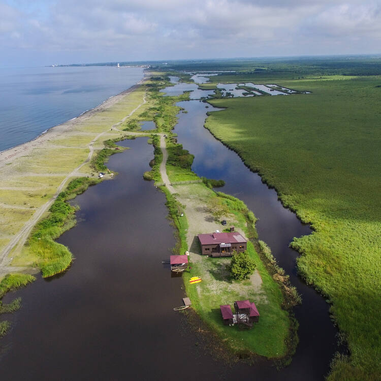
The property comprises seven component parts, within an 80km long corridor along the warm-temperate and extremely humid eastern coast of the Black Sea. They provide a series of the most typical Colchic ecosystems at altitudes ranging from sea level to more than 2,500 metres above it. The main ecosystems are ancient deciduous Colchic rainforests and wetlands, percolation bogs and other mire types of the distinct Colchic mire region. The extremely humid broad-leaved rainforests comprise a highly diverse flora and fauna, with very high densities of endemic and relict species, with significant numbers of globally threatened species and relict species, which survived the glacial cycles of the Tertiary. The site is home to approximately 1,100 species of vascular and non-vascular plants, including 44 threatened vascular plan species, and almost 500 species of vertebrates, and a high number of invertebrate species. The site also harbours 19 threatened animal species including sturgeon, notably the critically endangered Colchic Sturgeon. It is a key stopover for many globally threatened birds that migrate through the Batumi bottleneck.

Объект состоит из семи составных частей в пределах 80-километрового коридора вдоль умеренно-теплого и очень влажного восточного побережья Черного моря. Объект представляет собой ряд наиболее типичных колхидских экосистем на высотах от уровня моря до более 2500 м над уровнем моря. Основными экосистемами являются древние колхидские лиственные тропические леса и водно-болотные угодья, перколяционные болота и другие виды болот, характерные для региона колхидских болот. Влажные широколиственные тропические леса являются местом обитания для разнообразной флоры и фауны с очень высокой плотностью эндемичных и реликтовых видов, со значительным количеством видов, находящихся в угрожаемом положении в глобальном масштабе, и реликтовых видов, которые пережили ледниковые циклы третичного периода. На территории объекта обитает около 1100 видов сосудистых и несосудистых растений, в том числе 44 вида сосудистых растений, находящихся в угрожаемом положении, а также почти 500 видов позвоночных и большое количество видов беспозвоночных. На территории объекта также обитают 19 видов животных, находящихся в угрожаемом положении, в том числе осетровые, в частности, находящийся на грани полного исчезновения колхидский осетр. Объект является ключевой остановкой для многих видов птиц, находящихся в угрожаемом положении в глобальном масштабе, которые мигрируют через узкие пути Батуми.


Categories:

Landscape
Landscape

Labels:

UNESCO

Why visit:

Excursion

Fitness level:


Best visit time:

January
February
March
April
May
June
July
August
September
October
November
December

Access:

Car

Roads:

Gravel

Open:

Always

Info:


Clothing:

Seasonable


Connection:

Ok


Map and directions
By car By public transit Walking Bicycling

Add comment Cancel reply

Your email address will not be published. Required fields are marked

Author:
TopTourPlace.com
Created:
13.06.2023
Updated:
25.03.2025
ID:
48883