Home Twitter Telegram
First time here ?     Subscribe
  • Places
    • List
    • List (map left)
    • by Country
    • Table
    • Map
    • Simple view
    • Cameras
  • Services
    • List
    • Map
  • Tours
    • List
    • Map
    • Table
  • Site
    • About
    • Contacts
    • FAQ
    • For Place owners
    • Prices
    • Subscribe
  • Account
    • Login
    • Join (register)
    • Payment
    • Prices
    • Requests
  • Add
    • Add Place
    • Add Tour
    • Add Infrastructure
    • Add Content
    • Add Blog
    • Add Comment
    • Add Event
    • Add Rating
    • Add Request
  • Site Map
  • Partners
  • Support

Places Tours Services News Blogs Articles Events Authors Cameras Add Join

  • PLACES
    • List
    • Map
    • Table
    • List (near me)
    • Map (near me)
  • TOURS
    • List
    • Map
    • Table
  • SERVICES
  • Web Cameras
  • More
    • Blogs
    • News
    • Articles
    • Events
    • Authors
    • Telegram Channel
    • Telegram Chat
  • Site
    • Join compare
    • Plans & Prices
    • Contacts
    • FAQ
  • Add
    • Add Place
    • Add Content
    • Add Event or Date
  • Login
Add Tour
Add Sleep Place
Add Eat Place

Requests are available only for Business users !
Join as Business


Country:

Andorra

Value:

Regional value

Duration:

1 h

GPS:

42.519839, 1.568608
Go
Map
2.00
Engolasters Lake
Engolasters Lake
Lake
Lake

Country:

Andorra

Region:

Andorra

Value:

Regional value

Visit duration:

1 h

Description:

En Ру

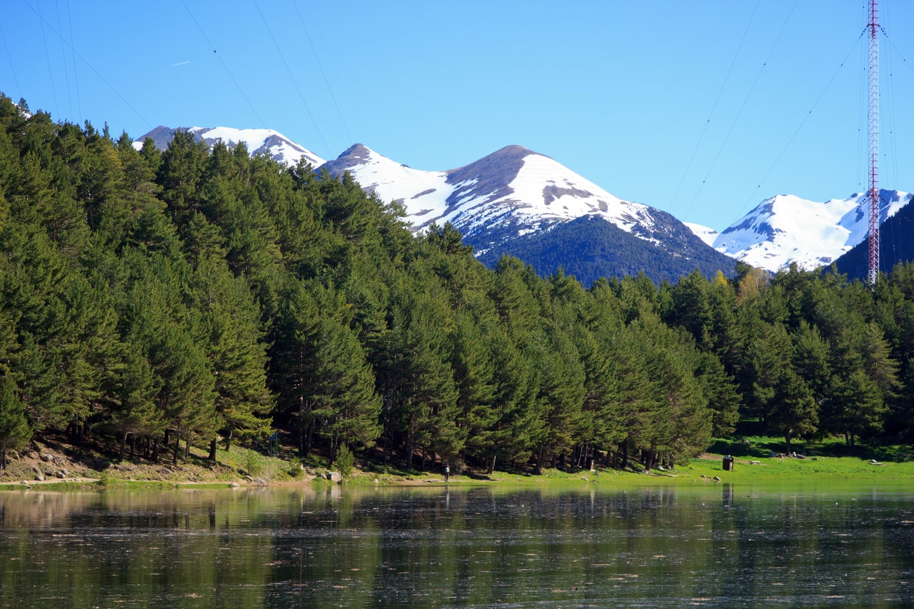
It is an oblong lake at an altitude of 1,616 meters. The lake was formed in a glacial basin. The water in the lake is dark blue and flows into a drainage basin formed by the snow-capped mountain ranges of the Pyrenees.

The lake’s water source is the Eastern Valira and Madrid rivers. The water stored in the reservoir is used to generate hydroelectric power at a power plant located near the village of Encamp.

A 6.2-kilometer cable car leads from Encamp to the lake.

Оно представляет собой озеро продолговатой формы на высоте 1616 метров. Озеро образовалось в ледниковой впадине. Вода в озере тёмно-синего цвета и стекает в дренажный бассейн, образованный покрытыми снегом горными хребтами Пиренеев.

Источником воды в озеро являются реки Восточная Валира и Мадрид. Запасённая в водохранилище вода используется для выработки гидроэлектроэнергии на электростанции, расположенной недалеко от деревни Энкамп.

Из Энкампа к озеру ведёт канатная дорога протяжённостью 6,2 километра.


Categories:

Lake
Lake

Tags:

Lake

Why visit:

Relax
Swimming

Interesting:


Fitness level:


Best visit time:

January
February
March
April
May
June
July
August
September
October
November
December

Access:

Bike
Car
Car 4x4
Foot
Motorbike

Roads:

Asphalt

Facilities:

Parking

Emergency:

112


Info:


Safety:

Safely


Clothing:

Seasonable


Connection:

Ok


Map and directions
By car By public transit Walking Bicycling

Add comment Cancel reply

Your email address will not be published. Required fields are marked

Author:
TopTourPlace.com
Created:
29.07.2024
Updated:
26.03.2025
ID:
195323