Home Twitter Telegram
First time here ?     Subscribe
  • Places
    • List
    • List (map left)
    • by Country
    • Table
    • Map
    • Simple view
    • Cameras
  • Services
    • List
    • Map
  • Tours
    • List
    • Map
    • Table
  • Site
    • About
    • Contacts
    • FAQ
    • For Place owners
    • Prices
    • Subscribe
  • Account
    • Login
    • Join (register)
    • Payment
    • Prices
    • Requests
  • Add
    • Add Place
    • Add Tour
    • Add Infrastructure
    • Add Content
    • Add Blog
    • Add Comment
    • Add Event
    • Add Rating
    • Add Request
  • Site Map
  • Partners
  • Support

Places Tours Services News Blogs Articles Events Authors Cameras Add Join

  • PLACES
    • List
    • Map
    • Table
    • List (near me)
    • Map (near me)
  • TOURS
    • List
    • Map
    • Table
  • SERVICES
  • Web Cameras
  • More
    • Blogs
    • News
    • Articles
    • Events
    • Authors
    • Telegram Channel
    • Telegram Chat
  • Site
    • Join compare
    • Plans & Prices
    • Contacts
    • FAQ
  • Add
    • Add Place
    • Add Content
    • Add Event or Date
  • Login
Add Tour
Add Sleep Place
Add Eat Place

Requests are available only for Business users !
Join as Business


Country:

Finland

Value:

World value

Duration:

1 h

GPS:

63.3, 999.999999
Go
Map
UNESCO
0.00
High Coast, Kvarken Archipelago
Architecture
Architecture

Country:

Finland

Region:

Finland

Value:

World value

Visit duration:

1 h

Description:

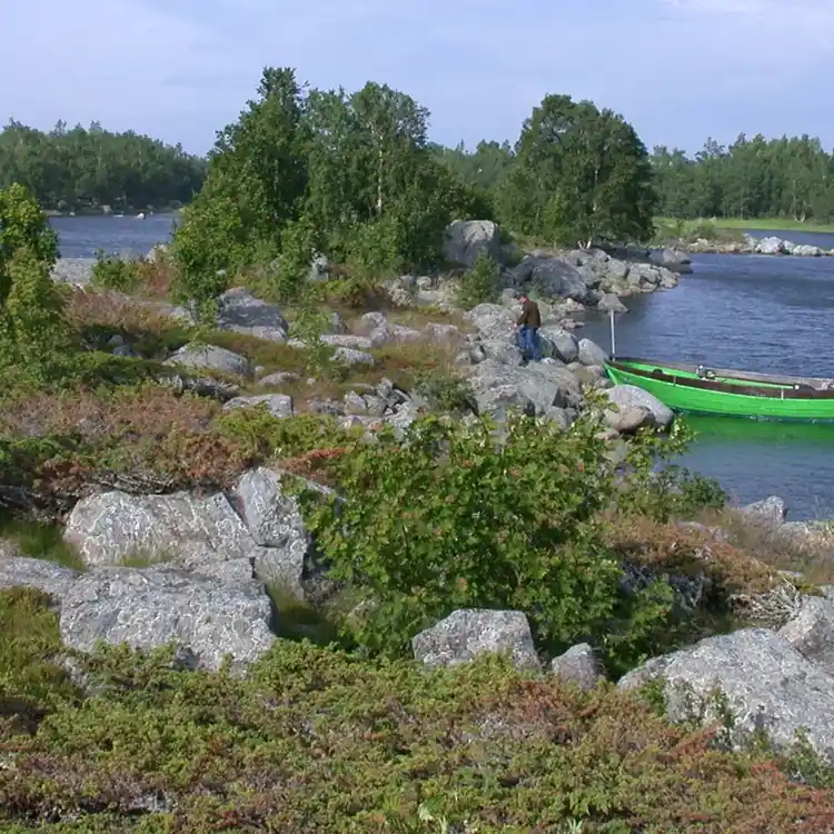
The Kvarken Archipelago (Finland) and the High Coast (Sweden) are situated in the Gulf of Bothnia, a northern extension of the Baltic Sea. The 5,600 islands of the Kvarken Archipelago feature unusual ridged washboard moraines, &lsquo,De Geer moraines&rsquo, formed by the melting of the continental ice sheet, 10,000 to 24,000 years ago. The Archipelago is continuously rising from the sea in a process of rapid glacio-isostatic uplift, whereby the land, previously weighed down under the weight of a glacier, lifts at rates that are among the highest in the world. As a consequence islands appear and unite, peninsulas expand, and lakes evolve from bays and develop into marshes and peat fens. The High Coast has also been largely shaped by the combined processes of glaciation, glacial retreat and the emergence of new land from the sea. Since the last retreat of the ice from the High Coast 9,600 years ago, the uplift has been in the order of 285 m which is the highest known “rebound“. The site affords outstanding opportunities for the understanding of the important processes that formed the glaciated and land uplift areas of the Earth“s surface.


Categories:

Architecture
Architecture

Labels:

UNESCO

Why visit:

Excursion

Fitness level:


Best visit time:

January
February
March
April
May
June
July
August
September
October
November
December

Access:

Car

Roads:

Gravel

Open:

Always

Info:


Clothing:

Seasonable


Connection:

Ok


Map and directions
By car By public transit Walking Bicycling

Add comment Cancel reply

Your email address will not be published. Required fields are marked

Author:
TopTourPlace.com
Created:
13.06.2023
Updated:
25.03.2025
ID:
49772