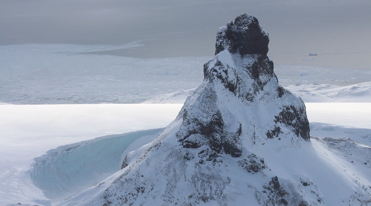
Home Twitter Telegram
First time here ?     Subscribe
  • Places
    • List
    • List (map left)
    • by Country
    • Table
    • Map
    • Simple view
    • Cameras
  • Services
    • List
    • Map
  • Tours
    • List
    • Map
    • Table
  • Site
    • About
    • Contacts
    • FAQ
    • For Place owners
    • Prices
    • Subscribe
  • Account
    • Login
    • Join (register)
    • Payment
    • Prices
    • Requests
  • Add
    • Add Place
    • Add Tour
    • Add Infrastructure
    • Add Content
    • Add Blog
    • Add Comment
    • Add Event
    • Add Rating
    • Add Request
  • Site Map
  • Partners
  • Support

Places Tours Services News Blogs Articles Events Authors Cameras Add Join

  • PLACES
    • List
    • Map
    • Table
    • List (near me)
    • Map (near me)
  • TOURS
    • List
    • Map
    • Table
  • SERVICES
  • Web Cameras
  • More
    • Blogs
    • News
    • Articles
    • Events
    • Authors
    • Telegram Channel
    • Telegram Chat
  • Site
    • Join compare
    • Plans & Prices
    • Contacts
    • FAQ
  • Add
    • Add Place
    • Add Content
    • Add Event or Date
  • Login
Add Tour
Add Sleep Place
Add Eat Place

Requests are available only for Business users !
Join as Business


Country:

Antarctica

Value:

Regional value

Duration:

1 day

GPS:

-72.183333, 26.25
Go
Map
3.00
Isachsen Mountain
Isachsen Mountain
Volcano
Volcano

Country:

Antarctica

Region:

Antarctica

Value:

Regional value

Visit duration:

1 day

Description:

The highest mountain of the East Antarctica Ranges, near the coast of Queen Maud Land. Large mountain rising to 3,425 m, standing 4 mi SE of Mount Bergersen in the Sor Rondane Mountains. Mapped by Norwegian cartographers in 1957 from air photos taken by U.S. Navy, 1946-47, and named for Major Gunnar Isachsen, leader with Captain Hjalmar Riiser-Larsen of the Norwegian expedition 1930-31.


Categories:

Volcano
Volcano

Interesting:


Fitness level:


Best visit time:

January
February
March
April
May
June
July
August
September
October
November
December

Access:

Bike
Car
Car 4x4
Foot

Roads:

Gravel

Info:


Clothing:

For the season


Connection:

Ok


Map and directions
By car By public transit Walking Bicycling

Add comment Cancel reply

Your email address will not be published. Required fields are marked

Author:
db9@toptourplace.com
Created:
23.08.2023
Updated:
26.03.2025
ID:
98957