Страна:
Регион:
Другие названия:
Значение:
Время визита:
Цена:
Почему Топ:
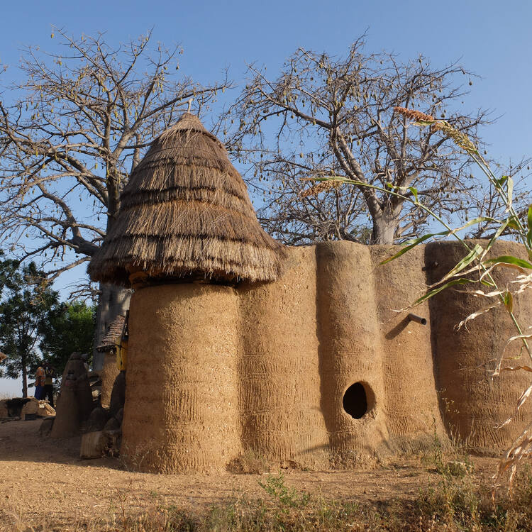
A living cultural landscape with unique tower houses symbolizing harmony between humans and nature.
Описание:
The area is inhabited by the Batammariba people, known for their mud tower houses called takienta. These dwellings reflect social structure, beliefs, and lifestyle. Architecture, rituals, agriculture, and natural elements form a unified cultural complex recognized by UNESCO. The Koutammakou landscape in north-eastern Togo, which extends into neighbouring Benin, is home to the Batammariba whose remarkable mud tower-houses (Takienta) have come to be seen as a symbol of Togo. In this landscape, nature is strongly associated with the rituals and beliefs of society. The 50,000-ha cultural landscape is remarkable due to the architecture of its tower-houses which are a reflection of social structure, its farmland and forest and the associations between people and landscape. Many of the buildings are two storeys high and those with granaries feature an almost spherical form above a cylindrical base. Some of the buildings have flat roofs, others have conical thatched roofs. They are grouped in villages, which also include ceremonial spaces, springs, rocks and sites reserved for initiation ceremonies.
Факты:
Covers about 271,826 hectares. In 2018, UNESCO conducted a damage assessment mission after heavy rains. The site was extended in 2023.
Значение:
Outstanding universal value, protected by UNESCO, listed as a World Heritage Site.
Категории:
Метки:
Зачем посещать:
Физподготовка:
Лучшее время:
Делать:
join guided tour
take photos
observe architecture
study culture
Доступ:
Roads:
Facilities:
Open:
Attendance:
Emergency:
117
Info:
Safety:
The site is safe, but it’s recommended to respect local customs and avoid photographing without permission.
Clothing:
Light clothing, closed shoes, sun protection, hat.
Climate:
Savannah, with distinct dry and wet seasons
Tips:
Book a guide in advance, carry cash, respect traditions, don’t touch sacred objects.
Connection:
Mobile signal is unstable