


бесплатно
Страна:
Регион:
Другие названия:
Значение:
Время визита:
Цена:
бесплатно
Почему Топ:
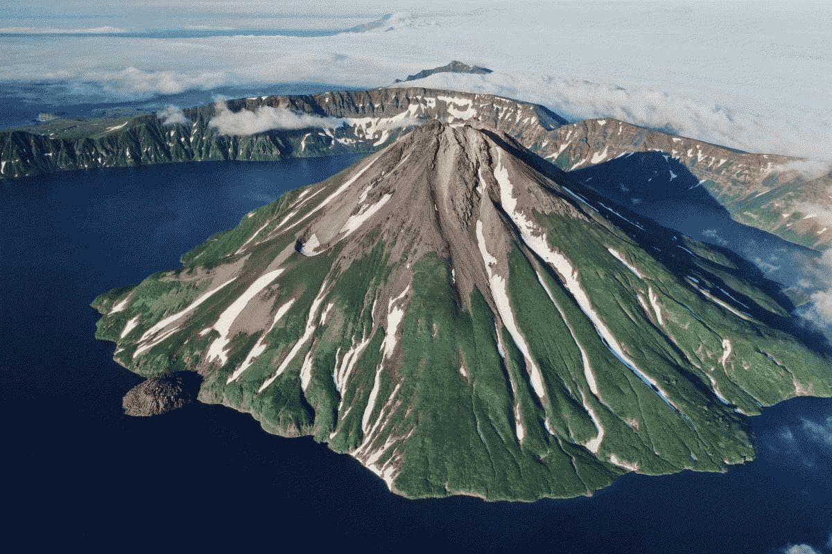
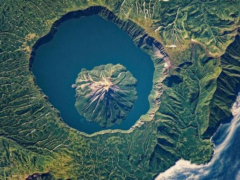
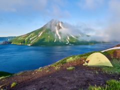
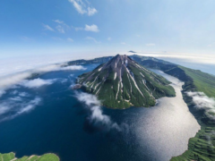
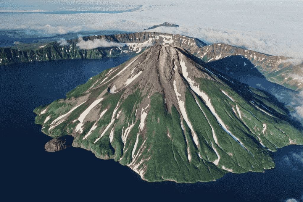
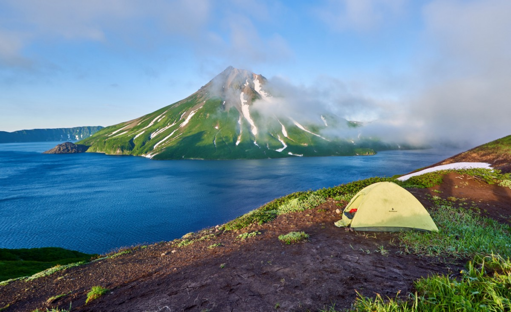
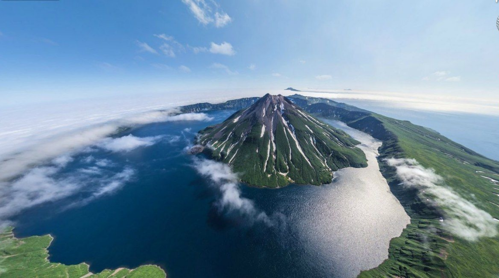
Огромный вулкан с кальдерой, где природа демонстрирует мощь и величие.
Описание:
Height 1324 m (the highest point of the island). A volcanic cone (with a base diameter of 3.5–4 km) rises in the form of an island inside Lake Koltsevoye lying at an altitude of 400 m (diameter about 7 km). The lake is surrounded by a somma — the walls of the more ancient Tao-Rusyr caldera (heights 540–920 m with a base diameter of 16–17 km). The caldera is composed of basaltic lavas and andesitic loose material, the volcanic cone is composed of andesites. The slopes are covered with dwarf cedar. There is only one known historical eruption, in 1952. Currently, fumarolic and thermal activity is being recorded. Named in 1805 by I. F. Kruzenshtern after the navigator Pyotr Kuzmich Krenitsyn.
Категории:
Темы:
Зачем посещать:
Интерес:
Физподготовка:
Лучшее время:
Доступ:
Roads:
Emergency:
112
Info:
Safety:
Safely
Clothing:
Seasonable
Connection:
Ok