Home Twitter Telegram
First time here ?     Subscribe
  • Places
    • List
    • List (map left)
    • by Country
    • Table
    • Map
    • Simple view
    • Cameras
  • Services
    • List
    • Map
  • Tours
    • List
    • Map
    • Table
  • Site
    • About
    • Contacts
    • FAQ
    • For Place owners
    • Prices
    • Subscribe
  • Account
    • Login
    • Join (register)
    • Payment
    • Prices
    • Requests
  • Add
    • Add Place
    • Add Tour
    • Add Infrastructure
    • Add Content
    • Add Blog
    • Add Comment
    • Add Event
    • Add Rating
    • Add Request
  • Site Map
  • Partners
  • Support

Places Tours Services News Blogs Articles Events Authors Cameras Add Join

  • PLACES
    • List
    • Map
    • Table
    • List (near me)
    • Map (near me)
  • TOURS
    • List
    • Map
    • Table
  • SERVICES
  • Web Cameras
  • More
    • Blogs
    • News
    • Articles
    • Events
    • Authors
    • Telegram Channel
    • Telegram Chat
  • Site
    • Join compare
    • Plans & Prices
    • Contacts
    • FAQ
  • Add
    • Add Place
    • Add Content
    • Add Event or Date
  • Login
Add Tour
Add Sleep Place
Add Eat Place

Requests are available only for Business users !
Join as Business


Country:

Andorra

Value:

Not defined

Duration:

1 h

GPS:

42.494722, 1.595556
Go
UNESCO
3.00
Madriu-Perafita-Claror Valley
Landscape
Landscape

Country:

Andorra

Region:

Andorra

Visit duration:

1 h

Description:

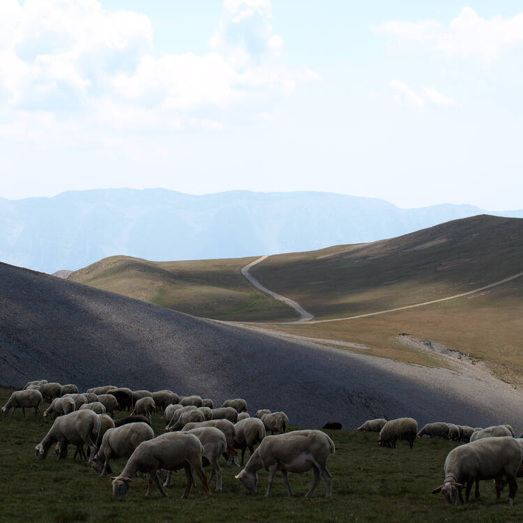
The cultural landscape of Madriu-Perafita-Claror Valley offers a microcosmic perspective of the way people have harvested the resources of the high Pyrenees over millennia. Its dramatic glacial landscapes of craggy cliffs and glaciers, with high open pastures and steep wooded valleys, covers an area of 4,247 ha, 9% of the total area of the principality. It reflects past changes in climate, economic fortune and social systems, as well as the persistence of pastoralism and a strong mountain culture, notably the survival of a communal land-ownership system dating back to the 13th century. The site features houses, notably summer settlements, terraced fields, stone tracks and evidence of iron smelting.


Categories:

Landscape
Landscape

Labels:

UNESCO

Topics:

Archeology
Historic Site
Nature

Why visit:

Excursion
Views
Walking

Interesting:


Fitness level:


Best visit time:

January
February
March
April
May
June
July
August
September
October
November
December

Access:

Bike
Car
Car 4x4
Foot
Motorbike

Roads:

Gravel

Open:

Always

Info:


Clothing:

Seasonable


Connection:

Ok


By car By public transit Walking Bicycling

Add comment Cancel reply

Your email address will not be published. Required fields are marked

Author:
TopTourPlace.com
Created:
13.06.2023
Updated:
26.03.2025
ID:
40100