Страна:
Регион:
Значение:
Время визита:
Почему Топ:
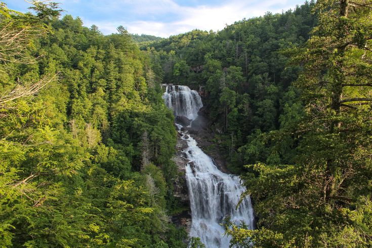
A North Carolina forest with rivers, trails, and mountains.
Описание:
The Nantahala National Forest anchors the far southwestern corner of North Carolina with over 528,000 acres of protected forest and high mountain wilderness. Within the National Forest, the Nantahala River flows through a gorge so lush that it only gets direct sunlight at mid-day. Nantahala is Cherokee for “land of the noonday sun.” Adjacent to the Great Smoky Mountains National Park, the Nantahala National Forest is the largest of the four National Forests in North Carolina. Within its boundaries are three designated Wilderness Areas and two Wild and Scenic Rivers. Much of the Nantahala National Forest can be enjoyed from the highway. Both the Waterfall Byway and the Cherohala Skyway wind through its hardwood forests, across mountain ridges, and alongside river gorges. The Nantahala River provides excellent rafting, canoeing, and kayaking and is one of the most popular whitewater rivers in the country. Three picturesque reservoirs are nestled among the mountains in the Nantahala National Forest, offering boating, water-skiing, fishing, swimming, and camping. Hikers can enjoy miles of developed trails, including the Appalachian Trail and the Bartram Trail, as well as backpacking in the wilderness. Horseback riding and mountain biking are also popular.
Категории:
Заповедник
Заповедник
Тэги:
Зачем посещать:
Интерес:
Физподготовка:
Лучшее время:
Доступ:
Дороги:
Удобства:
СОС:
112
Контакты:
Безопасность:
Safely
Одежда:
Seasonable
Связь:
Ok