Home Twitter Telegram
First time here ?     Subscribe
  • Places
    • List
    • List (map left)
    • by Country
    • Table
    • Map
    • Simple view
    • Cameras
  • Services
    • List
    • Map
  • Tours
    • List
    • Map
    • Table
  • Site
    • About
    • Contacts
    • FAQ
    • For Place owners
    • Prices
    • Subscribe
  • Account
    • Login
    • Join (register)
    • Payment
    • Prices
    • Requests
  • Add
    • Add Place
    • Add Tour
    • Add Infrastructure
    • Add Content
    • Add Blog
    • Add Comment
    • Add Event
    • Add Rating
    • Add Request
  • Site Map
  • Partners
  • Support

Places Tours Services News Blogs Articles Events Authors Cameras Add Join

  • PLACES
    • List
    • Map
    • Table
    • List (near me)
    • Map (near me)
  • TOURS
    • List
    • Map
    • Table
  • SERVICES
  • Web Cameras
  • More
    • Blogs
    • News
    • Articles
    • Events
    • Authors
    • Telegram Channel
    • Telegram Chat
  • Site
    • Join compare
    • Plans & Prices
    • Contacts
    • FAQ
  • Add
    • Add Place
    • Add Content
    • Add Event or Date
  • Login
Add Tour
Add Sleep Place
Add Eat Place

Requests are available only for Business users !
Join as Business


Country:

Chile

Value:

World value

Duration:

1 h

Cost:

free

GPS:

-34.084444, -70.382778
Go
Map
UNESCO
5.00
Sewell Mining Town
Sewell Mining Town
District
District

Country:

Chile

Region:

Chile

Value:

World value

Visit duration:

1 h

Price (adult):

free


Description:

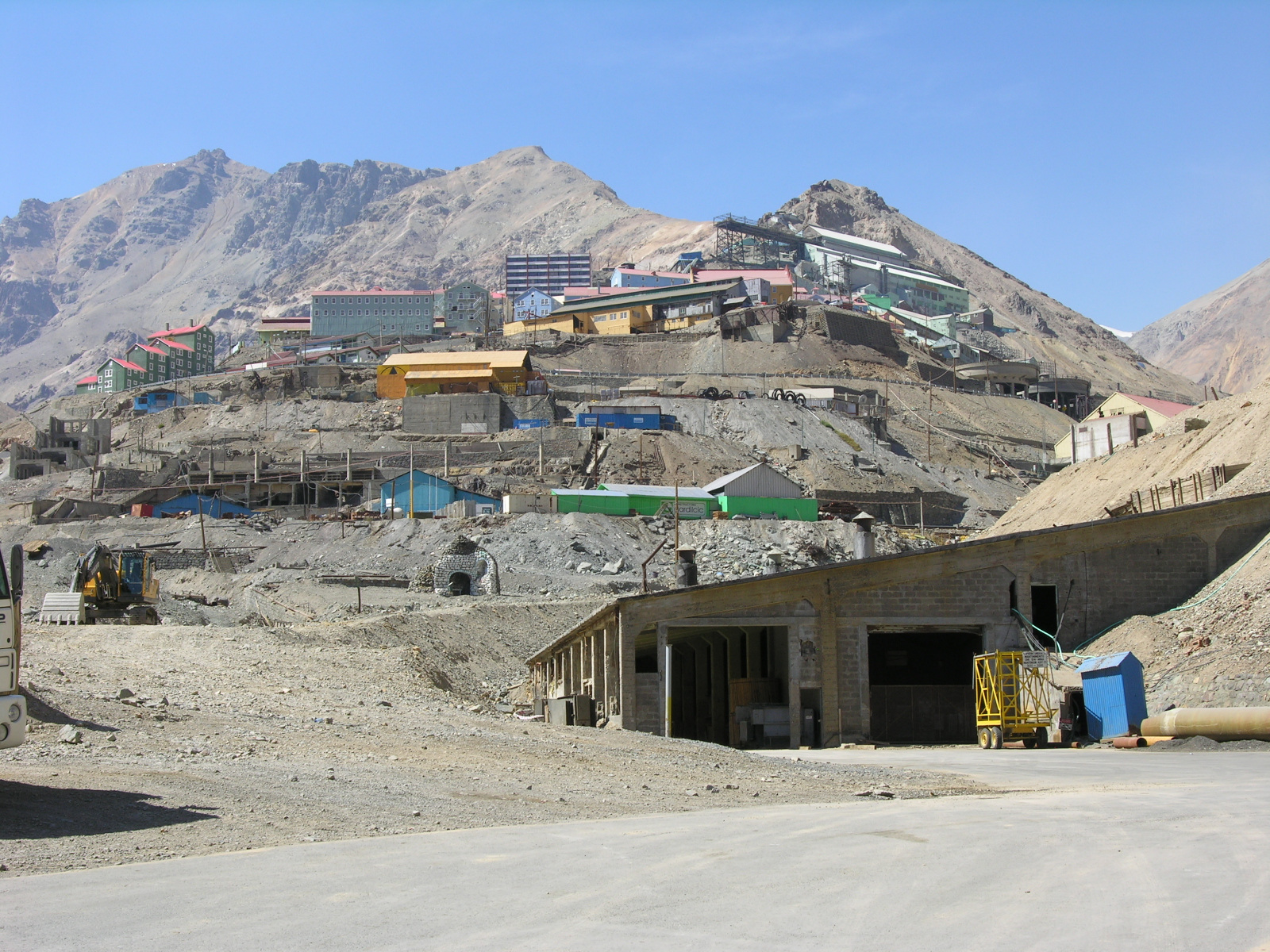
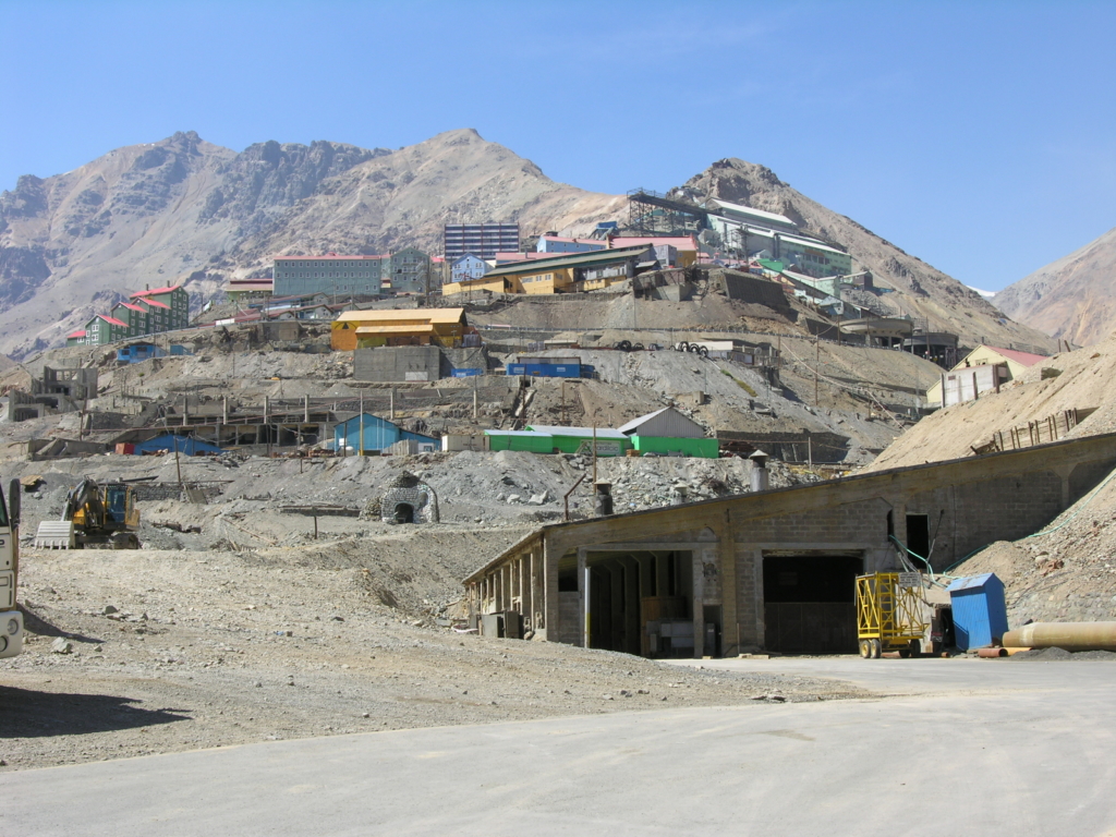
Situated at 2,000 m in the Andes, 60 km to the east of Rancagua, in an environment marked by extremes of climate, Sewell Mining Town was built by the Braden Copper company in 1905 to house workers at what was to become the world`s largest underground copper mine, El Teniente. It is an outstanding example of the company towns that were born in many remote parts of the world from the fusion of local labour and resources from an industrialized nation, to mine and process high-value natural resources. The town was built on a terrain too steep for wheeled vehicles around a large central staircase rising from the railway station. Along its route formal squares of irregular shape with ornamental trees and plants constituted the main public spaces or squares of the town. The buildings lining the streets are timber, often painted in vivid green, yellow, red and blue. At its peak Sewell numbered 15,000 inhabitants, but was largely abandoned in the 1970s.


Categories:

District
District

Labels:

UNESCO

Why visit:

Excursion

Interesting:


Fitness level:


Best visit time:

January
February
March
April
May
June
July
August
September
October
November
December

Access:

Bike
Car
Car 4x4
Foot
Motorbike

Roads:

Gravel

Open:

Always

Info:


Clothing:

Seasonable


Connection:

Ok


Map and directions
By car By public transit Walking Bicycling

Add comment Cancel reply

Your email address will not be published. Required fields are marked

Author:
TopTourPlace.com
Created:
13.06.2023
Updated:
25.03.2025
ID:
48924