
Страна:
Регион:
Значение:
Время визита:
Почему Топ:
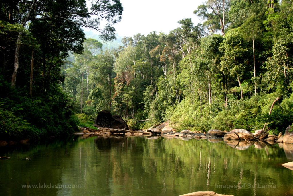
It is the last and largest viable remnant of lowland tropical rain forest in Sri Lanka.
Описание:
Located in south-west Sri Lanka, Sinharaja is the country`s last viable area of primary tropical rainforest. More than 60% of the trees are endemic and many of them are considered rare. There is much endemic wildlife, especially birds, but the reserve is also home to over 50% of Sri Lanka`s endemic species of mammals and butterflies, as well as many kinds of insects, reptiles and rare amphibians.
Категории:
Заповедник
Заповедник
Метки:
Темы:
Зачем посещать:
Интерес:
Физподготовка:
Лучшее время:
Доступ:
Дороги:
Открыто:
Контакты:
Детали:
In 1994 there were some 17,000 visitors. In 2000, at least 12,099 school children, 9,327 domestic visitors, and 2,260 foreigners visited the site. In 2002 the 36,682 visitors included environmentalists, university students, school children and foreigners, a pressure which is beginning to degrade the environment. (Forest Dept, 2003). There are three entrances: Kudawa, Morningsite and Pitadeniya, from the northern, eastern and southern sides respectively. Kudawa is the main entrance point, with a conservation office, an information centre, a Research, Education and Extension Centre, accommodation for 102 people in six dormitories and lodges, and tour guides. The Mulawella, Waturawa, Nawada tree trail, Gallen Yaya and Sinhagala nature trails start at this entrance. The Morningsite entrance, in the quite different submontane forest, has accommodation for ten people. Pitadeniya, south of Sinharaja, is being developed under the Southwest Rainforest Conservation Project funded by the Global Environmental Facility Programme of the UNDP. This is building an Information Centre, a dormitory, a bridge over the Gin Ganga river and opening up four nature trails. Eight guides should be available to assist visitors.
Одежда:
Seasonable
Климат:
The forest receives rain from both the northeast monsoon between November to January and the southwest monsoon from May to July. Almost all of it lies between the 3810mm and 5080mm isohyets. The average annual rainfall is over 2500mm with no dry spell: even the driest month, February, has an average of 189mm (Gunatilleke & Gunatilleke, 1983). There is little seasonal variation in temperature, but a high diurnal range: temperatures fluctuate between 19°C and 34°C (de Zoysa & Raheem, 1987) but the impact is minimised by the constant rainfall.
Связь:
Ok