
Страна:
Регион:
Описание:
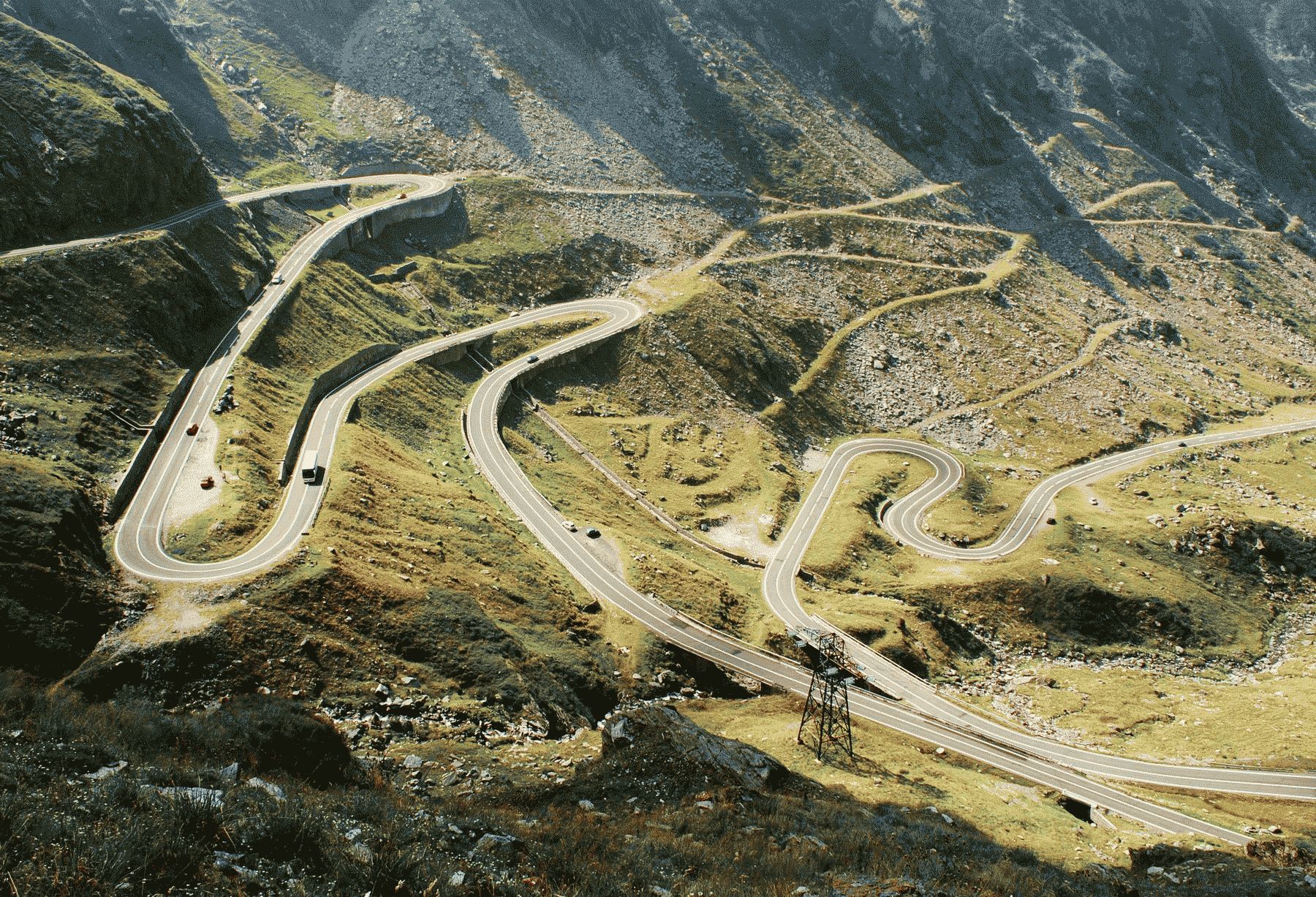
Originally it was supposed to be just a forest road. The invasion of the Soviet troops in Czechoslovakia and the autonomy from the USSR, on which Ceaușescu’s popularity was based, turned it into a road of strategic importance, which would connect Muntenia with Transylvania and which would allow troops from Transylvania to reach Muntenia, and vice versa, within a maximum of 12 hours. The investment holders were the Ministry of Forest Economy and Construction Materials on the northern side and the Ministry of Transport and Telecommunications on the southern side, in collaboration with the Ministry of National Defense, as an element of execution, for the entire route. In particular, the tunnel at elevation point of 2042 meters was entrusted to the Ministry of Electric Energy. The coordination of the activity of the troops deployed on the construction site was given to the Explosives Engineering Troops Command, also called the “1st Geniu Regiment”, led by Lieutenant General Vasile Șilicariu. In the beginning, two units of pioneers from the 1st Geniu Regiment “Alexandru Ioan Cuza”, Râmnicu Vâlcea, acted. Approximately 200 soldiers in each group approached the project from two sides: from north to south, from the Sibiu-Făgăraș road, towards the Bâlea Waterfall Cabin, and from south to north on the edge of Vidraru basin and the Capra valley. Later, in December 1970, the 1st Geniu Regiment joined and concentrated on the South side, while the 52nd Alba Iulia Geniu Regiment, commanded by Lieutenant Colonel Nicolae Mazilu, entered the North side. Pioneer units were also reinforced with soldiers from units of other arms, these soldier groups changing every six months.
The slope of the serpentines is 6% and only in a few places, in exceptional cases, exceeds 8%. The minimum radius of curves is 25 meters, and for serpentines 15 meters.
The length of the northern section is 35.1 kilometers. It starts on the Sibiu-Făgăraş national road, passes through Cârtişoara and continues to Lake Balea. The tunnel crosses the Fagaras ridge between the Capra and Paltinul peaks at an altitude of 2025 to 2042 meters and has a length of 887 meters.
The southern segment consists of two parts, the first from the tunnel exit, in the Capri Valley, is 25.6 kilometers long; the second departs from Arefu and follows the contour of Lake Vidraru, the total length of which is 29.5 kilometers. A total of 90.2 kilometers of two-lane alpine road.
For road construction approximately:
40 people died;
6,000,000 kilograms of explosives;
4,000,000 cubic meters of earthworks;
598,000 square meters of superstructures;
290,000 cubic meters of foundation;
290,000 cubic meters of brickwork;
830 cross works;
27 viaducts and bridges.
Besides the amazing landscapes, the Transfăgărășan Highway has many tourist attractions scattered along it, the most popular being The Bâlea Lake, The Poienari Citadel, The Vidraru Dam, The Curtea de Argeș Monastery and numerous engineering monuments. Towards Sibiu, we recommend you to visit the theme parks “Clay Castle of the Valley of Fairies”, “The Story of the Calendar” and “The Brambura Park”, each one with it`s unique charm.
Значение:
Время визита:
Цена:
бесплатно
Категории:
Тэги:
Темы:
Зачем посещать:
Интерес:
Физподготовка:
Лучшее время:
Доступ:
Access details:
It is possible to drive through the alpine area, between Bâlea Cascadă (Sibiu County) and Piscul Negru (Argeș County) between 07:00 – 21:00.
Дороги:
Удобства:
Открыто:
Загрузка:
СОС:
112
Контакты:
Безопасность:
Safely
Одежда:
Seasonable
Климат:
In the summer, you can enjoy pleasant temperatures, generally between 15 and 25 degrees Celsius, but the weather is quite unpredictable and rain can suddenly start. During the winter, temperatures drop a lot, often falling below -10 degrees Celsius, and snow is present starting from November-December until April.
Связь:
Ok
Ресурсы: